The vegetation profiles represent a generalised picture of the landscape. Each profile presents a typical landscape sequence. For each landform the following information is listed:
- a schematic drawing showing the vegetation structure;
- the main Ecological Vegetation Classes (EVCs) associated with it;
- a brief description of the vegetation;
- a brief description of the associated geology and soils;
- one or two location examples where intact native vegetation can be observed (if known);
- a link to a list of plant species grouped into trees, shrubs and groundcovers that are local to the area, suited to similar sites and can be used as a guide for planting projects.
It should be noted that the landforms presented may occur in different sequences in some areas. The profiles have been compiled to represent typical sequences, but these may not be the only ones.
To assist you to identify the appropriate vegetation profile and species list, Understanding Your Planting Profile , is suggested as a first step.
Use the profile name and descriptions to determine the ones most suited to your site. Click on the landform name to view the species list.
The vegetation in the Ranges revegetation zone has one profile containing different vegetation types.
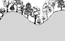
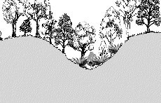
Upper Slopes and Steep gullies
Dry Ridges and Exposed Slopes - Western Ranges
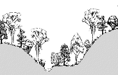
Dry Ridges and Exposed Slopes - Eastern Ranges
Protected Upper Slopes and Steep Gullies
| |
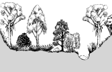
 |
| Geology |
Various geologies, soils fertile ranging from sandy loam to medium clay. |
| EVC |
Herb-rich Foothill Forest |
| Description |
Tall moist forest with Blue Gums, Messmate and Peppermint, and an open tall shrub layer with a diverse ground layer of herbs and grasses. |
| Examples |
Farrers Ln, south of Clendale Ln at the start of Murrindindi State Forest; Whittlesea Yea Rd, S of Minto Spur Rd; Whittlesea Yea Rd, 0.6km south of Tea Tree Rd |
| Species List |
Protected Upper Slopes and Steep Gullies species list |
Swift-flowing Streams
| |
 |
| Geology |
Alluvium and Colluvium, soils range from sand and gravel, with loam in some sites. |
| EVC |
Riparian Forest |
| Description |
On river flats and larger creeks typically with Manna Gums, and Silver Wattles and Blackwoods as a secondary tree layer. |
| Examples |
Glendale Ln, W of Farrar Ln and 2km off Maroondah Hwy; Delatite River along Mount Buller Rd 6km E of Merrijig. |
| Species List |
Swift-flowing Streams species list |
Swampy Drainage Lines
| |
 |
| Geology |
Alluvium and Colluvium, soils silty to clay loam. |
| EVC |
Swampy Riparian Complex |
| Description |
Woodland on poorly drained sections of streams and rivers, with a medium shrub layer and dense layer of sedges and ferns. |
| Species List |
Swampy Drainage Lines species list |
Moist Valleys
| |
 |
| Geology |
Various geologies, mainly colluvium. Moist, fertile soils. |
| EVC |
Damp Forest |
| Description |
Moist forest with a dense medium to tall shrub layer and a ground layer dominated by ferns and tree-ferns. |
| Examples |
Mt Disappointment State Forest along Main Mountain Rd between Harrys Nose East and Westcott Rd; Marysville State Forest along Falls Rd between Southern Tk and Water Race Tk; Marysville. |
| Species List |
Moist Valleys species list |