The vegetation profiles represent a generalised picture of the landscape. Each profile presents a typical landscape sequence. For each landform the following information is listed:
- a schematic drawing showing the vegetation structure;
- the main Ecological Vegetation Classes (EVCs) associated with it;
- a brief description of the vegetation;
- a brief description of the associated geology and soils;
- one or two location examples where intact native vegetation can be observed (if known);
- a link to a list of plant species grouped into trees, shrubs and groundcovers that are local to the area, suited to similar sites and can be used as a guide for planting projects.
It should be noted that the landforms presented may occur in different sequences in some areas. The profiles have been compiled to represent typical sequences, but these may not be the only ones.
To assist you to identify the appropriate vegetation profile and species list, Understanding Your Planting Profile , is suggested as a first step.
Use the profile name and descriptions to determine the ones most suited to your site. Click on the landform name to view the species list.
The vegetation in the Pyalong revegetation zone has been divided into two profiles containing different vegetation types.
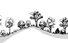
Soaks, Valleys and Low Hills
Rocky Stream Banks and Gorges
| |
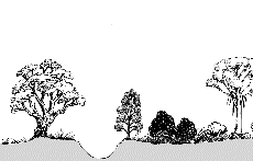 |
| Geology |
Alluvium from granite, soil sandy. |
| EVC |
Riparian Shrubland |
| Description |
Shrubland dominated with medium height shrubs found on rocky substrates of major streams and banks with a ground layer of sedges, rushes, ferns and herbs. |
| Examples |
Sandy Ck along Sandy Ck Rd W of Pyalong; Creek crossing along Allisons Rd off Pyalong Lancefield Rd; |
| Species List |
Rocky Stream Banks and Gorges species list |
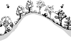
Protected Slopes
| |
 |
| Geology |
Granite with sandy clay loam soils. |
| EVC |
Damp Sand Herb-rich Woodland |
| Description |
Manna Gum dominated open woodland with scattered tall shrubs mainly Black Wattles, and a ground layer of bracken and herbs. |
| Species List |
Protected Slopes species list |
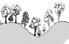
Springs and Soaks
| |
 |
| Geology |
Granitic outwash soils, poorly drained, usually moist throughout the year. |
| EVC |
Spring Soak Woodland |
| Description |
Woodland to 10m tall, however sometimes treeless, with an understorey dominated by a diversity of medium to small herbs with the occasional shrub. |
| Species List |
Springs and Soaks species list |
Valleys
| |
 |
| Geology |
Alluvium from granites, soil sandy loam. |
| EVC |
Valley Grassy Forest |
| Description |
Open forest in gentle sloping valleys dominated by Yellow Box and Peppermints with a tall shrub layer and dense grassy layer with a range of herbs. |
| Species List |
Valleys species list |
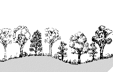
Hills
| |
 |
| Geology |
Granite with soils sandy and well drained. |
| EVC |
Grassy Woodland (Granitic) |
| Description |
Yellow Box and Candlebark dominated woodland with an open mid-storey of wattles and Sweet Bursaria, and a diverse grassy herbaceous ground layer. |
| Examples |
West Rd 3-5km W of Pyalong; |
| Species List |
Hills species list |
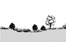
Dry Slopes
| |
 |
| Geology |
Granite with shallow soils |
| EVC |
Grassy Dry Forest |
| Description |
Open forest on steep dry slopes with a grass-dominated ground layer and a sparse shrub layer. |
| Species List |
Dry Slopes species list |
Return to profiles index