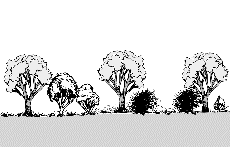
The vegetation profiles represent a generalised picture of the landscape. Each profile presents a typical landscape sequence. For each landform the following information is listed:
- a schematic drawing showing the vegetation structure;
- the main Ecological Vegetation Classes (EVCs) associated with it;
- a brief description of the vegetation;
- a brief description of the associated geology and soils;
- one or two location examples where intact native vegetation can be observed (if known);
- a link to a list of plant species grouped into trees, shrubs and groundcovers that are local to the area, suited to similar sites and can be used as a guide for planting projects.
It should be noted that the landforms presented may occur in different sequences in some areas. The profiles have been compiled to represent typical sequences, but these may not be the only ones.
To assist you to identify the appropriate vegetation profile and species list, Understanding Your Planting Profile , is suggested as a first step.
Use the profile name and descriptions to determine the ones most suited to your site. Click on the landform name to view the species list.
The vegetation in the Murray Fans revegetation zone has been divided into three profiles containing different vegetation types.
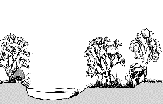
Floodplains
Floodplains (regular deep flooding)
| |
 |
| Geology |
Alluvial, mainly clay and silt soils. |
| EVC |
Riverine Swamp Forest |
| Description |
River Red Gum forest or woodland with understorey of flood dependant herbs, sedges and grasses. |
| Species List |
Floodplains (regular deep flooding) species list |
Floodplains (reasonably regular flooding)
| |
 |
| Geology |
Alluvial, especially on silt and sand soils. |
| EVC |
Grassy Riverine Forest |
| Description |
River Red Gum forest or woodland with understorey dominated by flood tolerant tufted grasses, notably Warrego Summer-grass. |
| Species List |
Floodplains (reasonably regular flooding) species list |
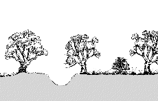
Floodplains (regular to occasional shallow flooding)
Floodplains (occasional shallow flooding)
| |
 |
| Geology |
Alluvial, silt and sand soils. |
| EVC |
Floodplain Riparian Woodland |
| Description |
River Red Gum forest or woodland with understorey dominated by Common Tussock-grass, often with Silver Wattle and Pale-fruit Ballart. |
| Species List |
Floodplains (occasional shallow flooding) species list |
Elevated Floodplains (flooding rare)
| |
 |
| Geology |
Alluvial, mainly fertile silt and clay soils. |
| EVC |
Riverine Grassy Woodland |
| Description |
Open woodland of River Red Gum above a short, tussock grassy ground layer, occasionally with shrubs including chenopods. Occurs on floodplains of major rivers in a slightly elevated position on deposited silts and sands. |
| Species List |
Elevated Floodplains (flooding rare) species list |
Shallow Inundations on Elevated Floodplains
| |
 |
| Geology |
Soils heavy, cracking mottled clays to clay loams, water retentive. |
| EVC |
Swampy Riparian Woodland |
| Description |
Open woodland of River Red Gum, sometimes with Black Box, above a grassy to sedgy herbaceous ground layer with species indicative of periodic water-logging. |
| Species List |
Shallow Inundations on Elevated Floodplains species list |
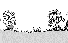
Edge of the Floodplains (flooding rare)
| |
 |
| Geology |
Alluvial, with heavy clay soils. |
| EVC |
Riverine Chenopod Woodland |
| Description |
Black Box dominated woodland with scattered medium shrubs and lignum, and a grassy ground layer with prostrate to medium sized chenopods. |
| Species List |
Edge of the Floodplains (flooding rare) species list |
Return to profiles index